-
Imja Valley and Island Peak
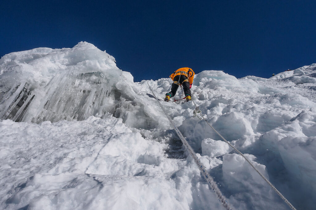
The steepest part of the ice wall of Island peak
-
Imja Valley and Island Peak
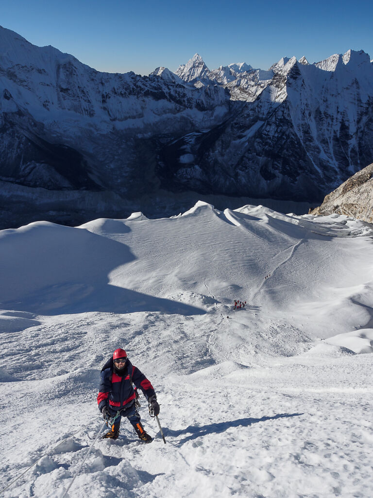
Climbing the ice wall of Island Peak
-

Imja Valley and Island Peak
Starting the climb of the ice wall of Island peak. Below is the ice plateau. Ama Dablam is to the right. The valley to the left le…
-

Imja Valley and Island Peak
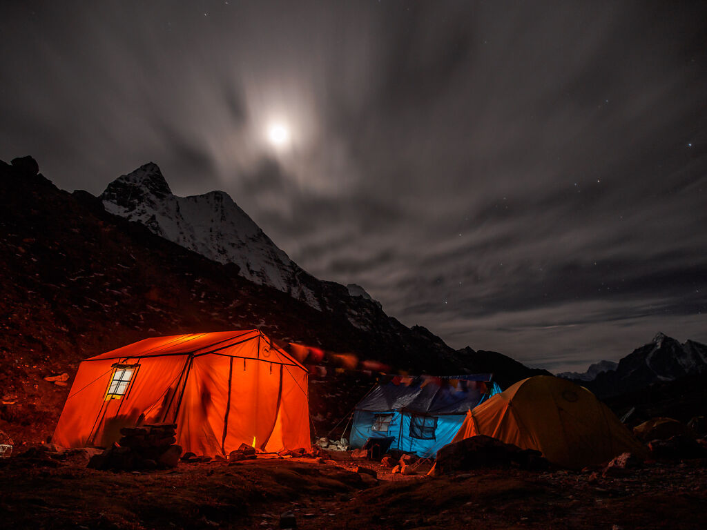
A night shot from Island Peak base camp. The peak itself is not visible from here.
-

Imja Valley and Island Peak
Looking east from just above Island Peak base camp. Cho Polu (6735 m) is the dome-shaped mountain to the left. Num Ri (6677 m) is…
-

Imja Valley and Island Peak
The Imja glacier melts and morphs into Imja Tsho (lake). The surreal silver color of this place comes from mica - a mineral that s…
-
Imja Valley and Island Peak
Moon rising over Island Peak base camp
-

Imja Valley and Island Peak
Island Peak base camp at sunset
-

Imja Valley and Island Peak
Island Peak base camp at sunset
-

Imja Valley and Island Peak
Island Peak base camp at sunset
-

Imja Valley and Island Peak
Approaching Island Peak base camp. The Baruntse-Kali Himal massif ( 7129 m) is the white one in the middle.
-

Imja Valley and Island Peak
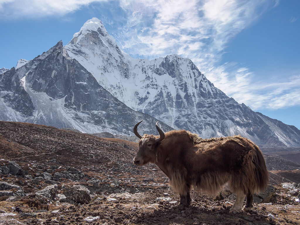
Yaks coming back from Island peak base camp
-

Imja Valley and Island Peak
2 nameless peaks south of Island Peak
-

Imja Valley and Island Peak
Looking back at Taboche (6542 m) from above Chukhung
-
Imja Valley and Island Peak
Ama Dablam (6812 m) from Chukhung
-

Imja Valley and Island Peak
A rest stop in Imja Valley. Lhotse's south face is behind.
-

Imja Valley and Island Peak
Imja Valley in the morning. Island Peak (6189 m) is the little pimple in the middle where the clouds seem to come from. The one to…
-

Imja Valley and Island Peak
Dingboche (4400 m)
-
Gokyo Valley and Cho La
Looking east from below Dzongla. To the right is Chola Tsho (lake).
-

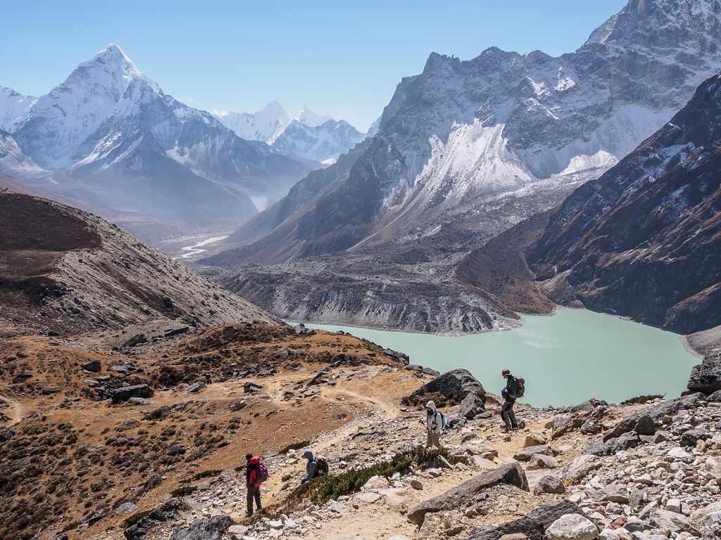
Gokyo Valley and Cho La
Dzongla with Mt. Ama Dablam behind
-

Gokyo Valley and Cho La
Mt. Ama Dablam (6812 m) dominates the view east of Cho La